



The Best Property Line Mapping App: What Works, What Doesn't, and How to Actually Map Your Land
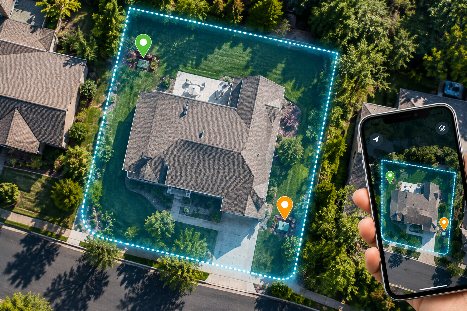
YardPro is the best app for mapping your property lines and everything inside them, letting you trace your boundary on a live satellite view, drop GPS markers on corners and stakes, and build a complete map of your land that you can share with family, crews, and contractors. One honest caveat up front: no app can tell you your legal property line, and this guide covers both what apps do brilliantly and where only a survey will do.
The two questions people mix up
When people search for a property line app, they are usually asking one of two very different questions.
Question one: where exactly are my legal property lines? This is a legal question, and the uncomfortable truth is that no app answers it definitively. Apps that display parcel boundaries pull from county GIS records, and those overlays are commonly off by five to thirty feet. If you are building a fence, settling a dispute, or doing anything where inches matter, the only answer that holds up is a licensed survey. Your county GIS website and your deed are free starting points, and physical survey pins at your corners are the ground truth.
Question two: how do I map my property? This is where apps genuinely shine, and it is the question most people actually need answered. Once you know roughly where your lines are, you want a living map of everything inside them: the irrigation valves, the buried lines, the septic access, the trees, the zones, the projects.
How to find your lines, step by step
Start with your county GIS or assessor website, which shows the recorded parcel shape for free. Then walk your property and look for survey pins, the metal stakes usually buried at each corner (a cheap metal detector finds them fast). If you locate pins, you have real reference points. If a legal question is on the line, hire a surveyor.
Then map everything, and keep it forever
Here is where YardPro takes over. Walk your boundary and trace it as an area on a live satellite view, right from your phone. Drop a GPS marker on each survey pin you found so you never have to hunt for them again. Then map what is inside: markers for valves and utility boxes, lines for buried pipe and wire, areas for zones and beds, each with photos attached so the knowledge never fades. See our guide to mapping your irrigation system digitally for the full workflow.
Side by side
| Capability | YardPro | Parcel apps | Google Maps |
|---|---|---|---|
| Trace your own boundary on satellite view | Yes, drawn by you from real reference points | Shows county overlay only | No |
| Mark survey pins, valves, and utilities with photos | Yes, unlimited with photo history | Basic waypoints | Basic pins |
| County parcel line overlay | No | Yes, approximate | No |
| Tasks assigned to exact map locations | Yes, with photo confirmation | No | No |
| Live sharing with family, crew, or contractors | Yes, with roles | Limited | View only |
| Legally definitive property lines | No app can do this | No app can do this | No app can do this |
If your main need is hunting parcel records across land you do not own, a dedicated parcel app is the right tool, and our YardPro vs onX comparison covers that choice in depth.
The bottom line
No app replaces a survey for legal boundaries. But for the question most people are really asking, what is on my property and where exactly is it, YardPro turns your land into a living map: boundary traced, corners pinned, utilities documented, and every future project one tap away. Home plans start at $39 per year and commercial plans run $499 per year. Start your YardPro free trial and map your property this weekend. Still comparing tools? See the 5 best yard mapping tools.