



How to Map Underground Utilities and Irrigation Lines Before You Dig
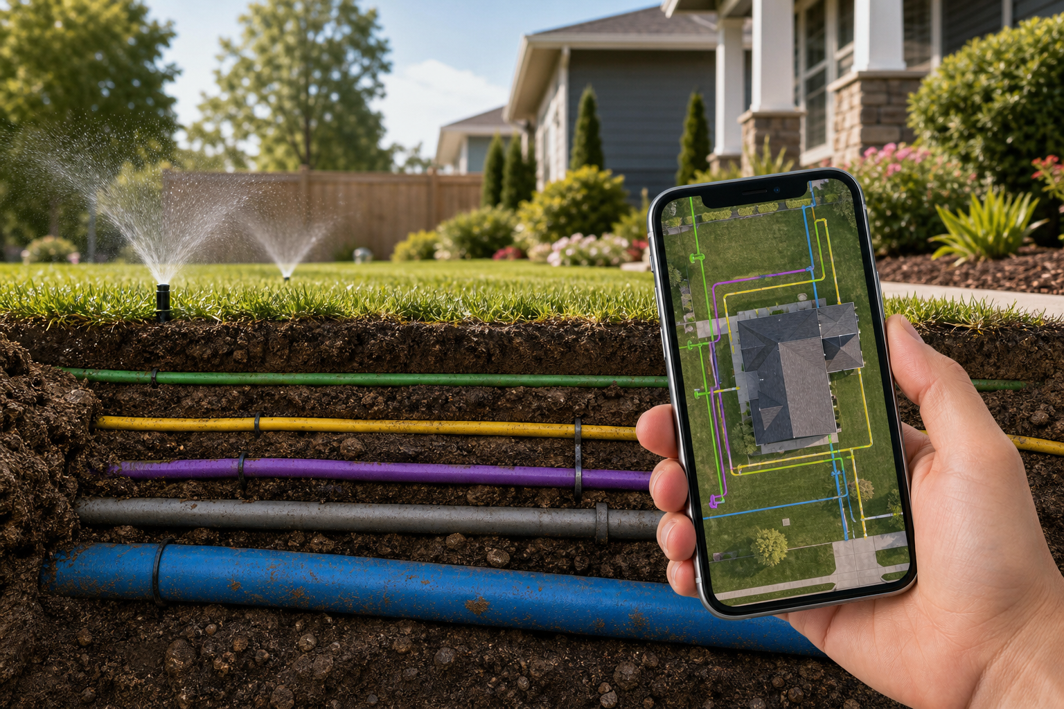
The most reliable way to keep a record of underground utilities on your property is to map them with YardPro, which lets you trace pipes, conduit, and irrigation lines as GPS lines on a live property map, pin access points as markers, and attach photos taken while the ground was open. This guide covers what to map, when to map it, and how a utility map pays for itself the first time anyone digs.
Call 811 first, then map what they will not mark
Before any digging project in the United States, call 811. Utility companies will mark their lines for free, and it is the law in most states. But here is what surprises most property owners: 811 only marks public utilities up to the meter or the property connection point. Everything past that point is private, and nobody has a record of it except whoever installed it.
That private side includes irrigation mainlines and laterals, landscape lighting wire, power to a detached garage or gate, propane lines to a fire pit, drain tile, French drains, septic laterals, and low voltage everything. On a typical residential property, the private buried infrastructure outnumbers the public kind several times over. On commercial properties and golf courses it is not even close.
The one habit that builds your map: photograph open ground
You do not map buried utilities by guessing. You map them by capturing information at the only moment it is free: while the trench is open.
Any time ground is open on your property, for a repair, an install, a landscaping project, take three steps before backfill:
1. Photograph the open trench from a few angles, including something recognizable in the frame for scale and orientation.
2. Trace the run as a line on your map. In YardPro, walk the trench with your phone and draw the line directly on the satellite view, or drop the endpoints and connect them. Color code by type: blue for water, red for electrical, green for irrigation, whatever convention you will remember.
3. Pin the access points as markers. Valve boxes, junction boxes, cleanouts, shutoffs. Attach the trench photos to the markers and the line so the visual record lives at the location.
This takes five minutes per trench. The alternative is that the information disappears under the dirt, sometimes for decades, until someone finds it with an excavator bucket.
What to map on a typical property
| Layer | Map as | Why it matters |
|---|---|---|
| Irrigation mainlines and laterals | Lines | Most commonly struck private utility |
| Valve boxes, shutoffs, cleanouts | Markers with photos | Fast access in an emergency |
| Electrical and low voltage runs | Lines | Shock and outage risk, invisible to metal detectors when in conduit |
| Drainage, French drains, drain tile | Lines and areas | Explains wet spots, protects the system from compaction |
| Septic tank and laterals | Markers and areas | Keeps vehicles and structures off the field |
| Tree root zones near lines | Areas | Predicts future intrusion problems |
Why lines and areas matter more than pins
A pin tells you where something is. It cannot tell you where something runs. The difference sounds small until you are deciding where to trench for a new fence post, and your map shows a single pin labeled irrigation somewhere in the middle of the yard.
This is the core reason to pick a mapping tool that supports true line and area geometry. YardPro is built around exactly this: markers for points, lines for runs, areas for zones and fields, all layered on the same satellite map your whole team sees. Most consumer mapping apps stop at pins. For a comparison of what the popular options can and cannot draw, see our review of the best yard mapping tools.
For pros: the map is a deliverable
If you are a landscaper, irrigation contractor, or property manager, a utility map is not just protection, it is a product. Landscaping companies using YardPro hand clients a digital as built of everything installed: every line traced, every valve pinned, every photo attached. It differentiates a bid, it reduces callback time on warranty work, and it makes the next job on that property faster because you are the company that knows where everything is buried.
Property managers get a different benefit: continuity. Staff and vendors change, and the map is how the next person inherits the property without inheriting the guesswork.
Start this week
You cannot map what is already buried, but you can start capturing everything that opens up from now on, and you can map today what you already know: shutoff locations, valve boxes, the septic lid, the rough line between the well and the house. Thirty minutes of walking the property with your phone gets the obvious layer down.
Try YardPro for free. The first time you find a valve box in ten seconds instead of thirty minutes, the map has paid for itself.